


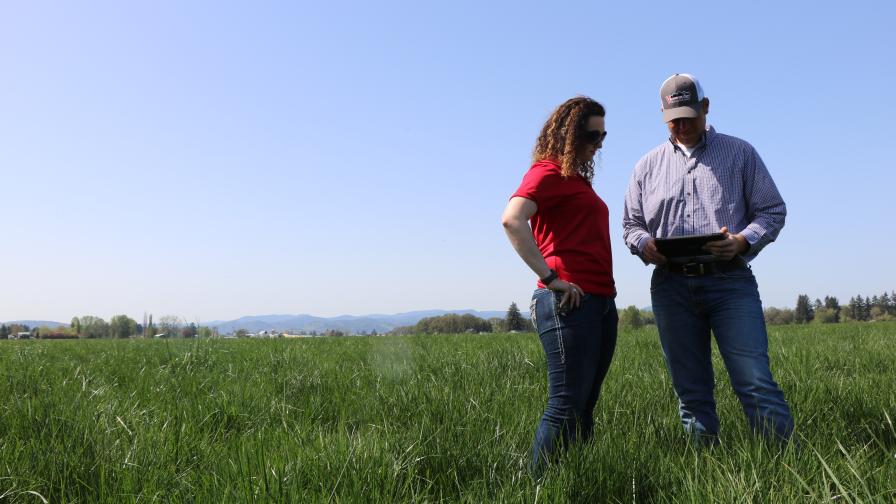
Making Sense of Prescription Maps for Variable Rate Irrigation

Variable rate irrigation (VRI) involves applying different amounts of water to different areas of the field. This innovative technology has many advantages. It allows farmers to:
- Maximize yields
- Save water
- Avoid or minimize nutrient leaching
- Avoid or minimize runoff
- Save energy
Agricultural fields never are uniform. Variability may be related to the soil or the crop itself. Soil is heterogenous and there will always be variability in soil properties throughout the field. Spatial variability in topography and soil texture greatly affect the water availability for the crop.
Soil texture may vary horizontally as well as throughout the soil profile. Soils of different textures retain different amounts of water and, therefore, will require different irrigation rates and scheduling. Sandy soils require more attention, as they can store only a small amount of water. Therefore, they must be irrigated more frequently and with smaller amounts of water in each irrigation. Too high irrigation depth in a sandy soil may result in water waste and leaching of nitrogen below the root zone of the crop.
On the other hand, heavy-textured soils can store more water and, therefore, must be irrigated at larger intervals and with greater amounts of water.
MORE BY GUY SELA
How Artificial Intelligence Is Driving a New Era of Precision Agriculture
Land topography will affect how efficiently water is distributed within the field in various ways:


- Slopes and elevation differences may result in pressure variations in the irrigation system, and therefore in water application uniformity.
- Water flow within the field is determined by its microtopography.
Planting density – In many fields, especially large ones, the farmer may decide to plant the crop in different planting densities and/or plant different varieties throughout the field. This results in different irrigation requirements for each zone of the field.
Planting date – In many cases, the field is planted gradually, resulting in zones with different development stages of the crop.
In variable rate irrigation, the field is divided into several irrigation zones, based on the above-mentioned factors, where each zone is considered to be homogenous and is managed individually. In permanent sprinkler and drip irrigation systems, each irrigation zone is controlled by an individual valve. Typically, one valve is operated at a time.
The vast majority of pivot irrigation systems today are used to water the field uniformly. However, precision variable rate irrigation systems offer new opportunities and are becoming more common.
Center pivot systems offer high control flexibility. Center pivot companies offer two types of variable rate control: “Sector VRI” or “Time VRI”. In this method, a prescription for pie-like slices is fed to the pivot. The names given by different pivot companies may vary commonly named “Sector VRI” and “Zone VRI”.
In Sector VRI, the field is divided into pie-like slices and speed of the pivot varies for each sector in order to apply the desired irrigation depth. Slow speed increases the irrigation depth, while higher speed reduces the application rate. The irrigation prescription is usually given as a colored map or a table listing the irrigation depth or relative pivot speed for each sector. Sectors are described as a range of angles.
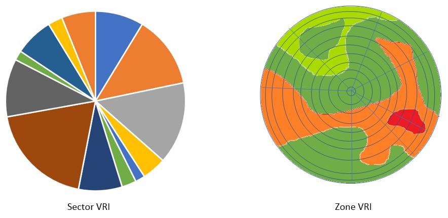
Zone VRI allows for even higher accuracy: smaller zones can be created by controlling the sprinkler valve pulse, where the coverage area is further divided to rings. This way, thousands of individual management zones can be defined. The prescriptions are usually generated using a prescription software and are uploaded to the pivot control system.
How is the Prescription Built?
That’s the $64,000 question. It’s great to have a pivot that can apply accurate water rates for each point in the field, but how can the grower know the optimal water rate for each zone?
Soil maps can be created using EC (Electrical Conductivity) mapping. Soil maps provide information on the variability in the field and can be uploaded into a software that can process the data and provide baseline application rates for each irrigation zone. The irrigation rate for each zone can then be adjusted based on the actual status in the field, such as weather conditions, planting densities etc.
Soil moisture sensors are being increasingly adopted by farmers and provide an opportunity for making variable rate irrigation fully automated and much more precise. Sensors can be installed in each irrigation zone and provide real-time data about soil moisture, salinity and other parameters.
Subscribe Today For
