By Matt HopkinsSenior Online Editor | Meister Media Worldwide
Share
(EDITOR’S NOTE: Today is a day that many in this industry have been awaiting for quite some time. With today’s implementation of FAA’s new Part 107 Commercial Drone regulations, the use of UAV technology and sensing becomes more accessible and economical for growers, consultants, retailers and the like, and we can’t wait to see how this long-discussed technology makes its mark across the farmscape. REJOICE!)
1
of
10
1
of
10
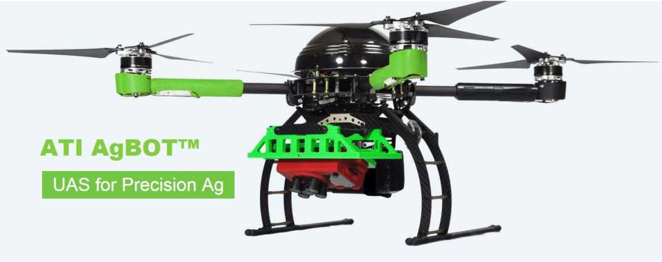
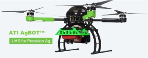
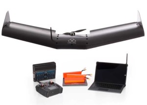
ATI AgBOT
The ATI AgBOT is a compact, industrial grade, aerial robotic craft designed for precision agriculture applications. It is fully autonomous, compact and durable, and packs down into a specially designed industrial strength case in minutes. Learn more >>
2
of
10
AgDrone
The AgDrone system is a completely autonomous UAS for agricultural surveying that comes standard with visible and multispectral cameras for high-resolution imaging and NDVI-based crop stress detection. Featuring durable Kevlar reinforcements and custom landing skids, the hand-launchable craft also comes equipped with mission planning software and a native tablet application to streamline data transport and processing in the cloud. Learn more >>
3
of
10
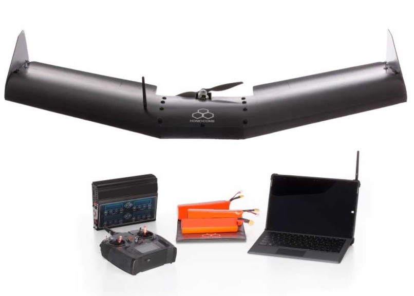
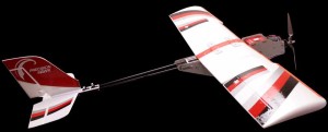
eBee Ag
The eBee Ag by senseFly features a range of camera options to suit different applications, from biomass estimation to yield monitoring and leaf area indexing. With its maximum flight time of 45 minutes, the eBee Ag can photograph areas of up to 2,470 acres in a single flight, claims senseFly. Learn more >>
4
of
10
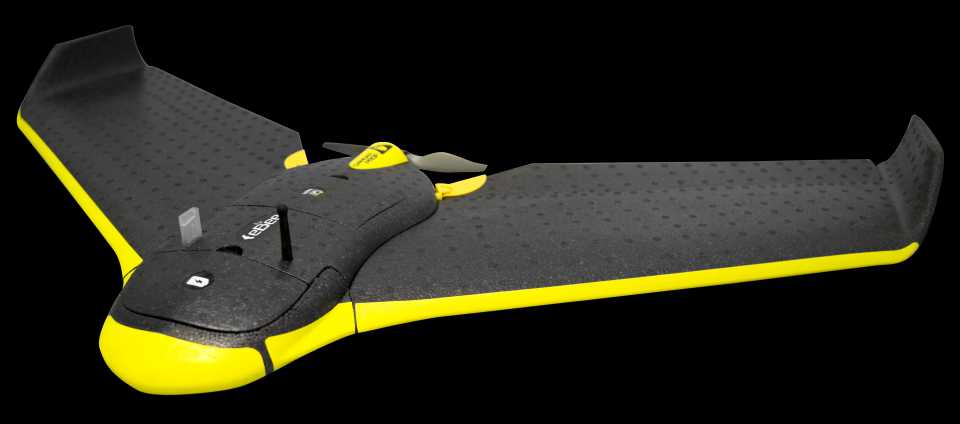
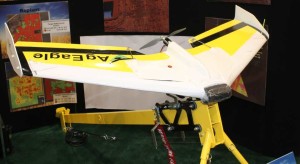
AgEagle
A complete fixed wing flying system with pre-flight planning and post-flight image processing software included, the AgEagle is built “tractor tough” and able to take the daily tough use that agricultural professionals need, according to the company. AgEagle is built for agronomists and farmers from the ground up; to create a scan pattern the user can just upload a shape file to RAPID’s pre-flight planning software. Learn more >>
5
of
10
AutoCopter G15
The AutoCopter G15 flies for two full hours carrying three cameras (multispectral, DSLR and HD Video), according to the company. The complete solution is equipped with live video downlink to the ground control station laptop, which is loaded with all of the software needed for pre-flight planning and post-flight processing. Learn more >>
6
of
10
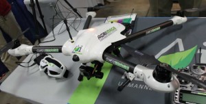
Ag Scout Extreme
The Ag Scout Extreme is a commercial grade UAS designed for accurate NDVI imaging and ortho-mosaic scans that are then processed into files for utilization in a farm data management system, according to the company. The system features a carbon-fiber constructed quadrotor craft comprised of commercial avionics components. Learn more >>
7
of
10
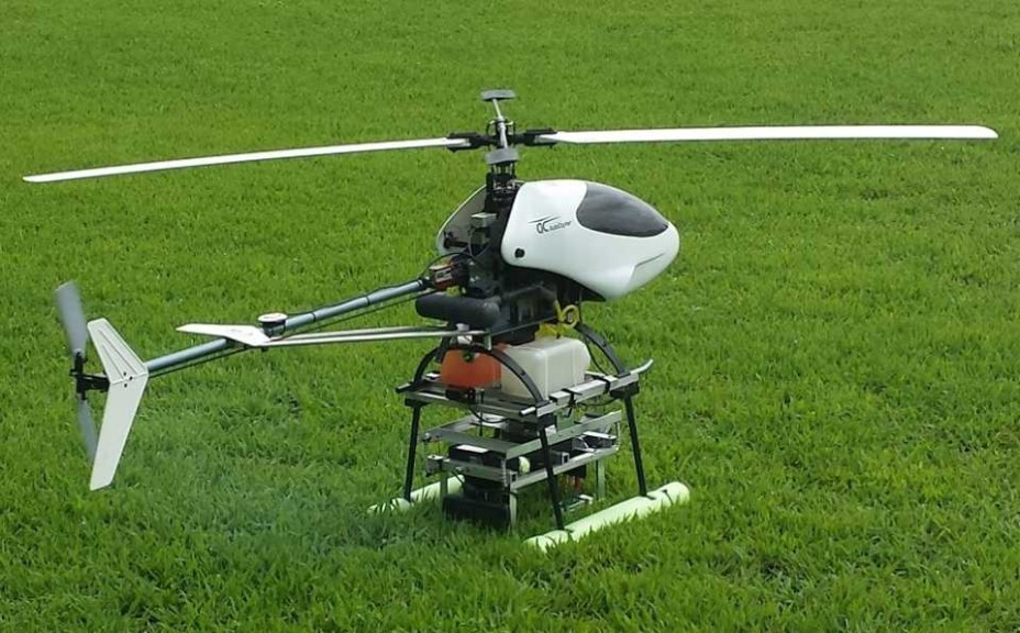
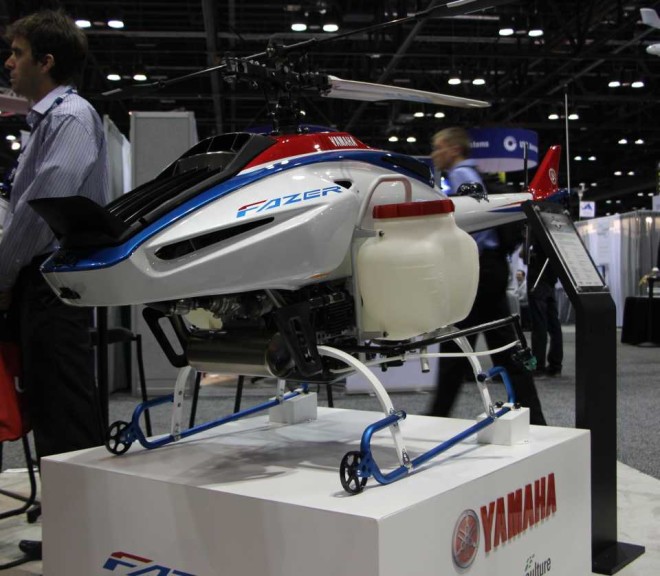
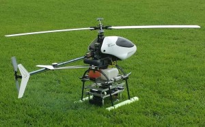
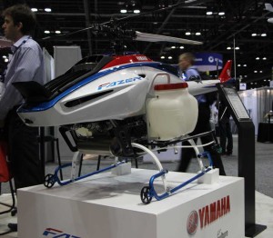
Fazer
The Fazer remotely-piloted helicopter from Yamaha Precision Agriculture updates the previous model (RMax) in three ways: Increased payload capacity (50% improvement over the previous model); improved controllability using a newly-designed transmitter and new control system; and cleaner exhaust emissions and quieter engine operation thanks to the fuel-injected four-stroke engine. Learn more >>
8
of
10
Lancaster MK III
At 4 pounds, PrecisionHawk’s Lancaster MK III UAV is designed with ease of use in mind. Equipped with Artificial Intelligence (AI) capabilities, the Lancaster automatically computes flight paths, survey parameters, take-off/landing paths, and in-flight diagnostics in order to collect the most accurate data possible. Learn more >>
9
of
10
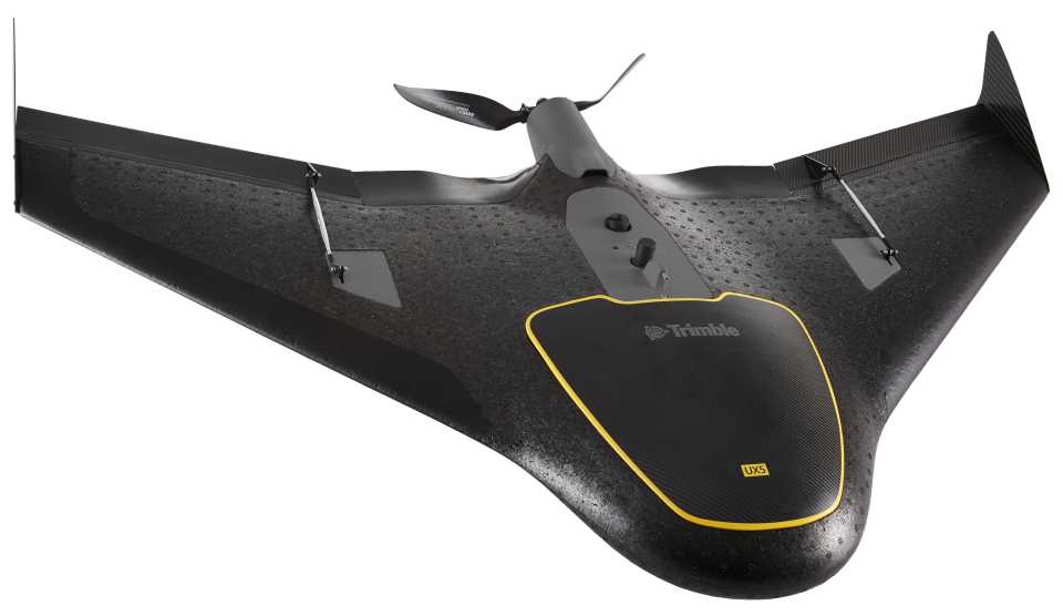
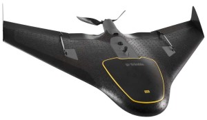
UX5
The Trimble UX5 Aerial Imaging Solution enables growers or their trusted advisors to quickly locate problem areas by easily capturing aerial images. This can enable issues to be more quickly addressed, which can potentially minimize negative impact on crop yield. Learn more >>
10
of
10
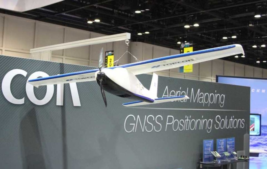
Sirius Pro
Sirius Pro uses GNSS RTK in combination with precision timing technology to determine the exact location for each of the positions at which a photo is taken. Sirius Pro’s flight planning software automatically adapts to an elevation model, allowing for flight in mountainous terrain; Sirius Pro covers an area that typically requires more than one flight with other UAS solutions, saving up to 30% flight time for large UAS missions, according to Topcon. Learn more >>
FAA testing and certification for small UAS remote pilot certificates begins in earnest this month (today, actually), but does that mean the commercial drone industry will see rapid growth, asks Colin Snow with DroneLife.com in a recent op-ed.
Advertisement
QuickTake
THE FACTS: Beginning Aug. 29, 2016 (EDITOR’S NOTE: That’s today! Hooray!), the new small UAS Rule for commercial drone operations in the U.S. takes effect. One very important change is that operators will now have to obtain a remote pilot certificate with a small UAS rating. Under the new rule—also known as Part 107—the person actually flying the drone must have this certificate, or be directly supervised by someone who has one. In advance, the FAA has published a variety of documents to assist businesses seeking to be compliant with the new regulation.