Generating Value From Boots-on-the-Ground Precision Ag
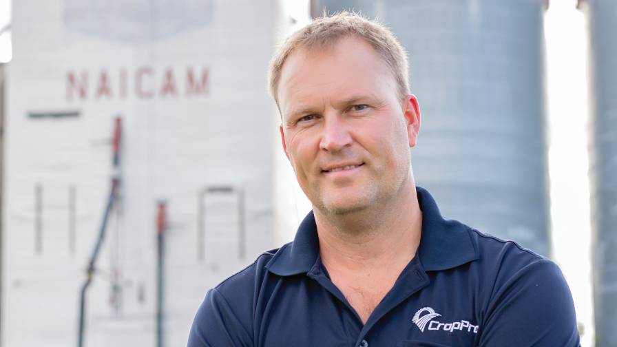
Canadian consultant Cory Willness uses hard work, common sense, and exclusive modeling to offer profitable precision agriculture services.
The flaghip product from CropPro Consulting, Naicam, Saskatchewan, may sound like part of a high stakes hostage situation. But SWAT (Soil, Water, and Topography) MAPS have a tamer, though still valuable, goal. They use key field information to create zone-based maps for variable rate application and seed application.
“In the North American market there really isn’t anyone doing it the way we do it,” says the company’s president, Cory Willness. “I don’t think we’d be having this conversation if we didn’t have these maps.”
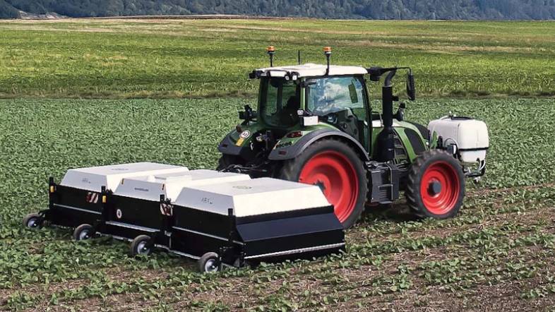
Trademarked and patented, the maps CropPro generates start at the “beginning,” says Willness. His team drives fields measuring — and then modeling — soil properties, water flows, and topography and how the three interact. “That gives you a better indication of what your fertilizer responses will be,” he explains.
The CropPro team has covered a grueling half-million acres in western Canada to make the maps. Adding to the challenge is the fact that there are only a few months of the year when this kind of work can be done.
MORE BY LISA HEACOX
There are no shortcuts here. No one has figured out how to map soils from the air yet, Willness points out. Agronomists can collect soil color from remote sensing — but that in itself isn’t good enough, he says. “It doesn’t give you textures or show where the salinity is.”
Building A Business
Willness has always had a passion for agronomy. After getting his degree, he was hired with a local ag retailer in eastern Saskatchewan in 1996. He also spent four years as an agronomist on the Saskatchewan VRT Project with a group of leading-edge farmers in the Melfort area that were using variable rate technology.
After building a reputation in the region for his work, he started his own independent consulting business in 2003. The start-up offered agronomy services that included weed, insect, and disease scouting as well as basic soil sampling and fertility planning. It launched with 25,000 acres and 10 customers.
While Willness was a veteran in VR technology, he wanted CropPro Consulting’s brand to be just right before he introduced it to growers.
“It was always my calling to find the right methods — mapping, putting all the pieces together — to offer a VR service that worked for us. So I spent a lot of time using different technologies and doing lots of trials before we commercially released our first VR service in 2008.
”That year we bought the first Veris sold into Saskatchewan. We hired staff, bought a lot of equipment and took a lot of training. That’s when we developed our SWAT MAPS — it was all agronomy up until 2008. The maps had very, very good uptake and every year since it’s been growing.”
Value Of Maps
One reason Willness says the maps are so good is because they’re stable. A field never changes, he points out. There will always be hills with water shedding, areas with the lowest organic matter areas, and depressions where water collects and salinity is a problem.
“Based on that, if growers want to fertilize for a dry year, they can. In wet areas that often have flooding — and accumulate nitrogen and sulfur — they can put on nitrogen stabilizers and increase seed rates. We have the only mapping process that separates soil into those types of zones.”
At presstime, Willness was about to start soil testing in southern Saskatchewan’s dryland. He’s guessing a fair amount of the nitrogen that growers put on this season is still going to be sitting in the hills there. Next year they can specifically manage the dry areas accordingly.
With variable rate work it can be tricky to nail down a return on investment, he admits.
“There’s going to be a percentage of the time where it doesn’t pay to put on fertilizer, much less put it on variable-rate. But these days a 10,000-acre farm is spending $1 million on fertilizer. Our annual cost for a farm like that would be around $3 per acre to do soil testing, prescriptions and two trips to the field to see how things are looking. That $30,000 bill is only 3% of the budget when a grower is spending $1 million.
“We position it more as it’s just every field being micromanaged every year with the fertility plan that customers believe in — that their fertility dollars are being spent in the right spots.”
Proving The Product
Typically growers will try CropPro’s SWAT systems on 500 or 1,000 acres, in the spring or fall, before deciding to use them on a whole farm. Trial fields are mapped and sampled and the firm gives prospective clients the new prescriptions. After one season using them, farmers make a decision.
Some clients who have done their homework, who have tried other methods and are dissatisfied, or who have talked to other growers using CropPro’s modeling for years will just sign on, no “tire-kicking” needed.
Jeff Prosko, co-owner of Prosko Farms, Rose Valley, SK, says he “tried them all” — a bunch of other area consultants and retailers before turning to CropPro for agronomic and mapping services in 2008. Every canola and oat field his family farms has been SWAT-mapped, to the tune of 21,000 acres.
Highly variable, his land is moderately rolling, and clay, loam and sand soil can all exist in one field. Some new portions of fields, cleared in just the last five years, run alongside ground that’s been farmed for 60 years.
Prosko has long been an avid user of variable rate fertilization. “With VR we’re putting the fertilizer where it should be, where the soils are depleted,” he says. “Where they’re not depleted, we’re cutting back instead of over-applying and just wasting money. We’re not spending less overall on fertilizer, but we’re putting it where it should be, growing more bushels.”
He’s also doing variable-rate seeding. The farm’s high salinity areas make it difficult to get a crop established, so he’s using higher seed rates in some areas to try and get a better stands there. He knows overall plant survival will be lowest in these extreme soils due to wetness, compaction and salt. Another goal here is to drive root growth to open up the soil and channel the salinity downward.
Prosko has also used SWAT MAPS for drainage planning. Next up is to use them to variable-rate fungicides, correct soil phosphate levels and adjust micronutrients, including cooper, boron and zinc. And he’s just getting in to variable-rating nitrogen stabilizers to help fix soils with high potential for nutrient loss.
Prosko and his family also run a small independent retail operation that offers a full line of products and services, including seed, chemicals, anhydrous, custom application, and a couple of helicopters to do aerial spraying. While he has agronomists on staff, he doesn’t feel they compete with CropPro.
“We encourage farmers that want a full-on VR program to go to CropPro because we feel they’re superior on that end,” he says. “We’re not going to re-invent the wheel when there’s a fantastic system with Cory and his staff right here. We work together.
“We also enjoy working with clients of CropPro in our retail because we feel confident that they’re getting good recommendations when they come to us looking for inputs. We probably don’t have to worry about those guys as much.”
Seeding Expertise
Willness say his team has been playing with variable rate seeding since 2008. In the past, they judged fields’ capabilities by simply looking at them, deciding which areas could use more or less seed based on their “boots on the ground” in the spring. Then in 2012 they undertook a massive data collection project, surveying hundreds of fields by zone, taking photos and quantifying seed performance by looking at plant stands, then creating zones aggregating the results and correlating them with other SWAT MAP layers.
CropPro now has six years of photos and data to guide seed decisions. This information layer has been used most for advice on extreme areas that establish poorly — especially hills that are “lumpy or sandier or drier” or in depressions where soils are wetter, packed harder or have salinity issues.
The company has done variable rate variety recommendations as well for canola. “That technology matches perfectly to what we do because we’re trying to find varieties that are more tolerant to drought or moisture stress and plant them in those specific parts of the field,” Willness says. “That totally matches our mapping processes.”
Colin Rosengren, co-owner of Rosengren Farms, Midale, SK, takes variable varieties to the next level — actually changing up different crops in his fields based on CropPro’s SWAT MAPS. At presstime he was harvesting intercropped pea/canola/lentil fields. He had identified which zones were most suited to the needs of each of the three crops.
He’s also doing variable rate fertilizer. The practice has worked very well in his operation, especially on monoculture crops. One example: malt barley. “Since we started with the CropPro program, we’ve hit malt, and the quality has been exceptional every year,” he says. “This year in the drought, our protein was 13 again, and our yields are as good or better than neighboring fields. Our proteins are much more in spec because we’re not applying nitrogen in the spots that just don’t have that yield potential — so we’re not getting those protein spikes. We’re getting a much more uniform product and quality.”
Contrasting Approaches
Rosengren notes that in his area most of the companies touting their mapping and variable rate programs are using infrared and other methods to create zones in fields. “They don’t have the same logic that SWAT MAPS do,” he says.
Most people want to start with the end point — satellite imagery and yield maps — which are measuring the crops’ response to things in the field, adds Willness. They don’t show the reasons why yields are high or low, whether an area is yielding low because dryness, bugs, flooding, or salinity. He says they can’t really guide growers on fertilization and other inputs.
Willness does use some imagery to create yield potential maps. “If you can pull 10 years of images and they’re very consistent, you have a nice correlation from year to year, then you can confidently nail down what your yield potentials are in various areas of the field.
“But up here, 50% of the time there’s no relationship from year to year. It’s like there are so many wet years and dry years and so many things affecting the crops all the time, it always looks different. It’s not a consistent way to say what the yield potentials are.”
Going forward, CropPro Consulting’s number-one project is to scale up SWAT MAPS production. “I think we’ve got a system we like now,” says Willness. “In the next couple years we expect to go to the western Canada market with it. We’re focused on our agronomy services and VR services. Business as usual is labor intensive.”
The company currently has a staff of 20, all passionate about precision ag and what they do, says Willness. He gives them the credit for his firm’s advances in products, services, and technology. “Our staff is our No. 1 asset,” says Willness.
Grower Rosengren has seen the CropPro team in action. “They’ve been hiring the best and the brightest from universities, so that’s made them a really strong organization. Cory has a great team because of the way he is and how he leads and what he’s done. It’s an attractive place, and he’s been able get the best.”


