


Drone Milestone? Sentera’s 2019 PHX Achieves 1,000 Acre Coverage in Single Flight

 Farm drones have come a long way (a veritable COUNTRY MILE, if you will) since they first started hitting the InfoAg trade show floor back in 2013, and they’ve come an even longer way in the last two and a half-plus years since FAA’s Part 107 regulations led to 37,579 remote pilot certificates being issued in the first six months of the program alone.
As many surely remember, the early days of drone technology in ag were filled with excitement and lofty expectations and, well, let’s just call them “let-downs.” The tech was cool, it was useful in certain situations, but it didn’t scale enough to truly disrupt the large satellite imagery providers and fixed-wing aircraft fleets imaging fields out West.
Having covered the drone industry as it pertains to farming at that time for over three years, I felt comfortable enough in my sense of what the segment needed to truly take off (ie mass adoption) with ag service providers to issue a sort of declaration (known today as a HOT TAKE) to the companies making noise in the space: “someone figure out how to image 1,000 acres on a single battery charge, and then I think we’ve got something, Tonto.”
At the time of issue of that blazing hot drone take, Sentera’s then-Phoenix (shortened now to just PHX) fixed wing sat perched atop the imaginary drone coverage leaderboard at 700 acres on a single battery charge. In the runner-up slot was senseFly’s eBee+ and it’s promised 500 acre coverage ceiling, and so on.
MORE BY MATTHEW J. GRASSI
VISION Conference Preview: Someday, AI Might Grow Better Plants than People
2019 Commercial UAV Expo: 3 Quick Revelations From an Ag Drone Expert
Specialty Crops: 8 More Precision Technology Companies We’re Keeping an Eye On
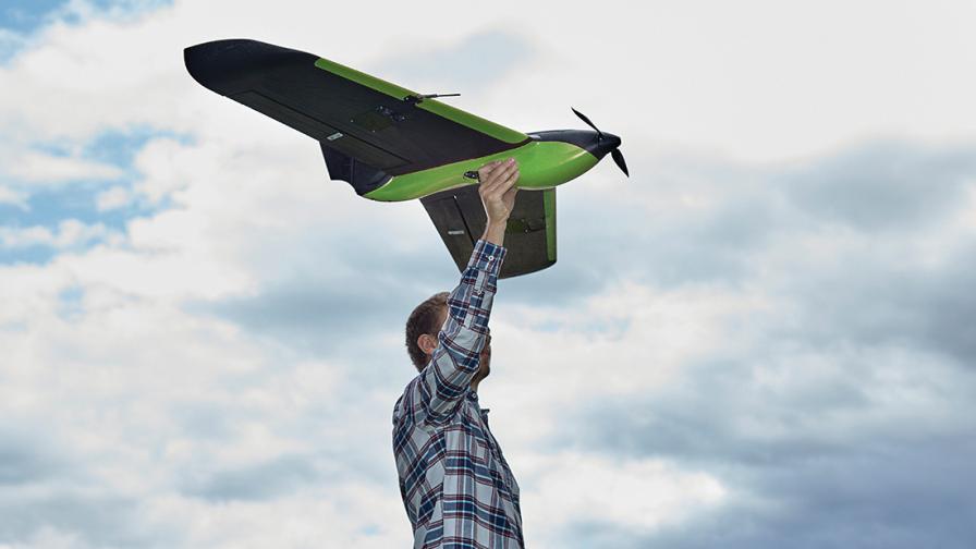
Being that they were so tantalizingly close two years ago, it didn’t really surprise me much when I received an email from Sentera’s marketing folks that a Sentera drone pilot had mapped an entire 1,000 acres of dryland corn down on the Texas Gulf Coast last month.

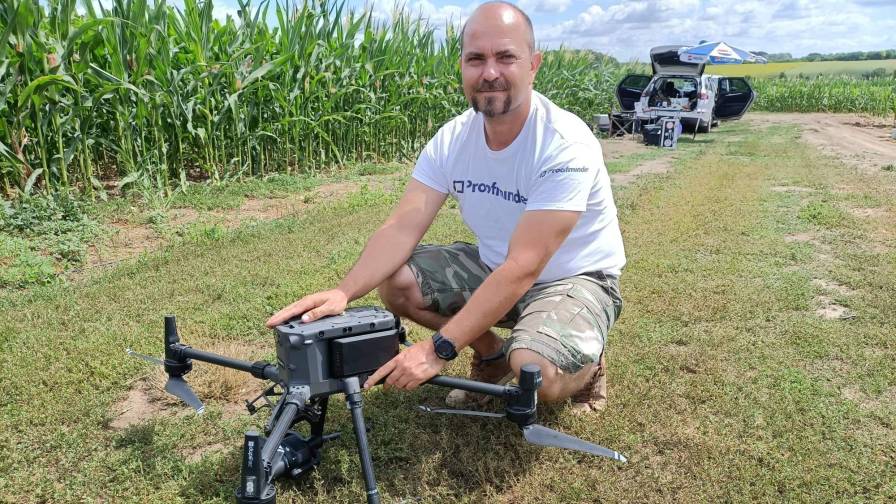

Todd Colten, Chief Aerospace Engineer, Sentera.
“Wayne is one of our Sentera employees, he helps pilot and we were doing some stand count work in corn with our new analytics,” Todd Colten, Sentera’s chief aerospace engineer, shared from company HQ in Minneapolis. “This particular field was a contiguous area right at 1,000 acres, just a huge, huge corn field. We said ‘Let’s push it and put the boundary out a little further than usual’ and Wayne did the 47 minute flight, normal conditions, and he mapped the whole 1,000 acres.”
Colten noted the wind was about 10-12 mph at the time, considered medium wind conditions by Sentera, and the flight altitude was right at the 400 ft Part 107 ceiling. Visual line-of-sight was maintained for the entire flight, so no waivers were needed, either. “Fully Part 107-compliant,” is how Colten put it.
Having collected aerial data before myself, but on a much, much smaller scale, my first thought was “Geez, that data set had to be just enormous…”
“I know exactly what you’re getting at,” Colten replied. “Sentera approaches that a couple different ways. The short answer is for this flight we used our quick tile mosaic maps feature where we fly with minimal overlap (20-30% overlap versus the typical 75-80% most professional mapping jobs require), so I think for this flight we were right at about 1,000 images, and then I will admit for such a big job I think he processed the data on a normal laptop, right there at the edge of the field, and it took about 40 minutes in post-processing.
“And then we took that same data set back to the office and we tried to have it stitched manually with a traditional image stitching program and it was just too big of an area,” Colten continued. “So, to your point, yes, it was probably too big of a data set to deal with in typical conditions, but Sentera has come up with a solution to make dealing with large data sets practical.”
So, I suppose it begs the question, what can you do with a data set (ie map) like the one Wayne captured down in Texas?
“You definitely can do all of the same zone management stuff that we normally do (with drone imagery), this particular flight was in early season, v2 corn, it’s pretty young corn and that’s about the stage where you want to do stand counts and maybe find areas where there are problems with the planter,” Colten said. “We actually did second flight at slightly lower altitude over that same field and we were able to make a weed map. There didn’t look to be too many weed problems, just from looking at it at edge-of-field, but once we got into the middle of the field there were a ton of weeds that we couldn’t even see just driving by, so I thought that was also a pretty interesting use case.”
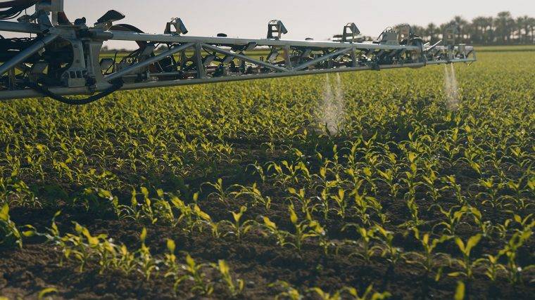
New stand count analytics and weed mapping features are two of the areas Sentera invested R&D manpower in recently, according to Colton, as well as equipping the 2019 PHX with a new omni-directional antenna that doesn’t require the pilot move it mid-flight to maintain signal strength. Thinking about where the industry at-large seems headed in the crop protection category, the weed mapping capability seems particularly useful going forward, considering the growing interest in getting away from blanket application of herbicides into a more spot-treatment scenario, whenever possible.
“Traditionally, they (farmers) are doing a blanket spray over the entire field at a constant rate, right? But, obviously with all the issues lately with Roundup, the cost is going up on that product, or you’re dealing with Roundup resistant weeds and having to use some of the more expensive chemistries, they’re looking at what else can they do,” Colten explained. “Think about that field we just discussed, it’s a perfect example of a field that could benefit from variable rating herbicide.
“The center of that field had much higher weed pressure (than the edges) so you could make a zone in the middle and you could put that zone at your typical full rate spray rate, or even bump it up a little bit higher (if the label allows), and then around the edges, where you have less weeds, you can dial those rates back and perhaps save on some chemical.”
That brings up another burgeoning trend in the ag drone space, and that’s the coming wave of crop protection application by drone that is starting up overseas as U.S. folks wait for regulations that would allow more test flights and R&D in that area.
“I can tell you that weeds and weed management (via drone) is a huge area of focus for Sentera and our technology development people,” Colten shared. “What we’re doing with PHX is just one piece of that, one small piece, but we’re working on a lot of that with some of our other sensors and products, and also on the image processing side.
“At the moment, we’re not directly playing in that spray drone world, although we do work with companies that do manufacture spray drones. I’d say at he moment we’re really focused n making weed maps and pressure maps, and also what we call ‘precision weed mapping’ where it’s a bit of a lower altitude imagery and we run algorithms over it to find and identify individual weeds. So that takes it from a weed pressure map to an every weed map.”
Colten says that Sentera’s focus going forward remains on “what do you do with the data”, and the Twin Cities-based group is working on things like field-edge processing and delivery (of imagery) and even live processing, as well as continuing the work with integrating advanced camera and multi-spectrum sensing payloads that Sentera has become known for in the drone world.
“We understand the scalability problem, and that’s…we’re just pushing and pushing towards making things easier and faster to process.”
Subscribe Today For
