


Mapping and Spot Spraying Invasive Weeds With Drones

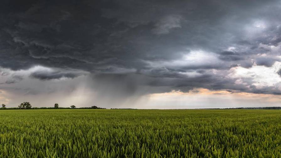
Non-native Phragmites, also known as the common reed, are a perennial, aggressive wetland grass that outcompetes native plants and displaces native animals. Phragmites tend to grow in disturbed wetland areas and are an indicator of a wetland ecosystem that is out of balance. There are multiple problems that Phragmites cause, most notable being fire risks, biological, visual, and recreational obstructions.
Troy Gibbs, a Rantizo Application Services Contractor in Wisconsin, has worked with Applied Ecological Services, the Wisconsin Department of Natural Resources, and Allied Cooperative, Pest Pros Crop Consultants on a project to spray an area affected by Phragmites grass. The project location was the Turtle Valley Wildlife Area in southern Wisconsin, where the spraying application was done in early fall, 2020.
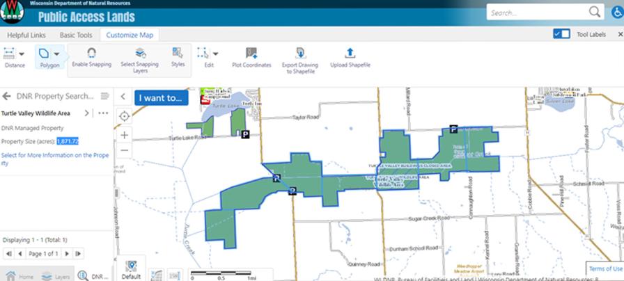
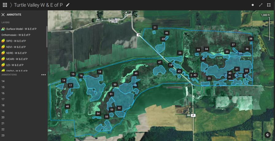
The location of the affected area – Turtle Valley Wildlife Area, Wisconsin.
Applied Ecological Services, under the Wisconsin Department of Natural Resources, was looking to have approximately 1,400 acres of marshland spot treated for the invasive weed. This required the project area to be flown and mapped to identify the locations of the invasive Phragmites grass before applying treatment.
At the time of drone mapping flight, the Phragmites were seeding, so it was easier to identify the invasive species from aerial maps. Once located and marked, the areas of spot treatments were exported to the spray drone. The end result of this workflow ended up being a digital map used by the DJI AGRAS MG-1 for spot spraying, covering areas anywhere from 0.1-10 acres.
MORE BY BARBARA HORVATIC
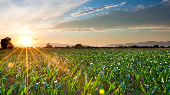

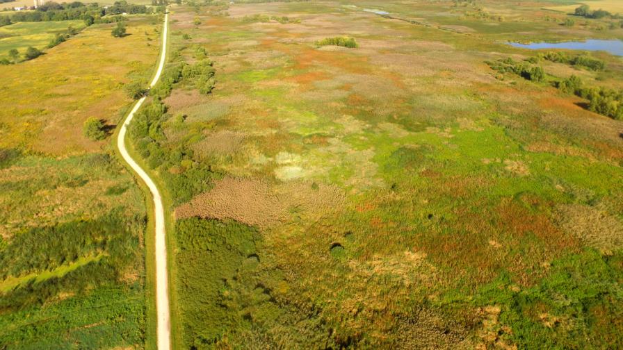
Phragmites are patches of darker colored grass identifiable from the above image.
“Being as patchy as Phragmites are and with some obstacles in the area (trees), mapping with my DJI AGRAS would be inefficient and potentially not as accurate as I’d like it to be. We were looking to have it mapped and shapefiles created that we can use to spray with the AGRAS drone,” Gibbs said.
Creating Invasive Species Spray Zones with Pix4Dfields
Troy worked on the project with Austin Headlee, an agronomist from Allied Cooperative, Pest Pros Crop Consultants. Headlee flew the area using a senseFly eBee SQ with a Parrot Sequoia multispectral camera and covered the many acres without any problems. He flew the wildlife area in sections to make the spraying easier later on.
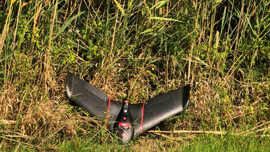
Mapping the Phragmite affected area with a senseFly eBee SQ.
After flying a section of the marshland Headlee processed the imagery into maps using Pix4Dfields. Within the software he was able to easily identify and map the invasive species of Phragmites grass.
“One thing I’d like to note is that my first summer in college I mapped Phragmites by hand for the U.S. Fish and Wildlife service branch that I interned at,” he said. “It took me 3 months to map 2,000 acres by hand with a pair of leaky waders, a kayak, and a handheld GPS. With this drone and Pix4D I mapped 2,000 acres in 2.5 days; the difference is enormous in manpower savings, the accuracy is just as good, and time consumption is obviously extremely less. I took about 13,000 images and had around 12 continuous hours of flight time for this project.”
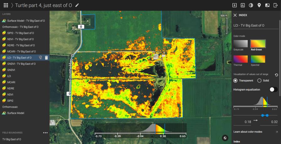
Pix4Dfields LCI index run through the advance layer visualization feature to highlight affected areas.
This was specifically made easier by using the Pix4Dfields advanced layer visualization feature. Headlee pointed out he typically used the Leaf Chlorophyll Index (LCI) for mapping this invasive species. LCI proved to pick Phragmites out the best but it seemed the other indices worked as well.
Headlee also used Pix4Dfields to create zones around each of the areas to treat (spray) and then exported and sent the needed shapefiles to Gibbs to be used with his spray drone.
Creating shapefiles in Pix4Dfields to be used by the spray drone.
Precision Spot Spraying With a DJI AGRAS Drone
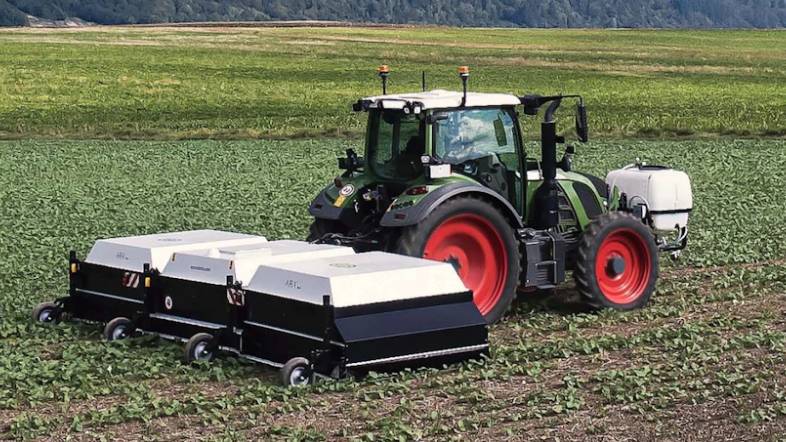
Gibbs owns and operates a DJI AGRAS MG-1 modified with the Rantizo’s spray upgrade kit. This technology makes it possible to spray twice as many acres in the same time as the stock model. Gibbs loaded the shapefiles into his controller and Imazapyr Polaris AC Complete (aquatic approved herbicide that has shown to be very effective on Phragmites), into the tank specified by Applied Ecological Services, Inc. After loading the product, he worked to precisely spray each area where Phragmite grass was located.
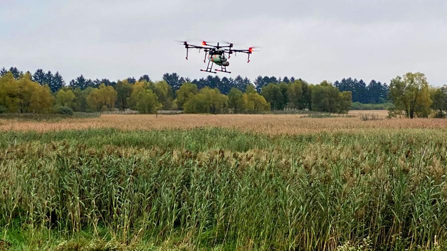
Spot spraying the Phragmites with the DJI AGRAS MG-1.
Saving Money and Protecting the Environment
“By mapping and spraying only the Phragmites, we were able to cut back on the chemical used and minimize the impact on any non-target plants. We were able to spray it with unmatched accuracy and better consistency than compared to a helicopter or ground sprayer,” Gibbs said.
When Gibbs was asked how he sees the future of this technology and other applications from what he has learned, he replied: “I saw the benefits of this technology firsthand on a large-scale project and it was impressive. We were able to apply the product only where it needed to be, which was especially important in a state wildlife area. The Wisconsin Department of Natural Resources was able to maximize the amount of Phragmites treated while leaving the non-target areas unaffected. The efficiency and precision capabilities the technology can offer were highlighted in this type of work environment.”
This was the first known instance of the Wisconsin Department of Natural Resources precision spraying invasive species, which was clearly a great example and step forward. In this instance, drone mapping and spot spraying proved useful in saving valuable time and money, but also contributing towards advancing ecological habitats with precision.
Subscribe Today For
