


AgVu: Hyperspectral Sensing On Deck For Ag


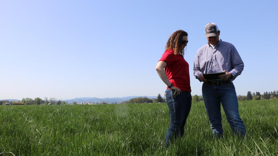
This image compares true color (left) vs. hyperspectral (right) images processed via Advanced Reconnaissance Corp.’s AgVu service in corn. (Source – ARC)
Advanced Reconnaissance Corp. (ARC), an outfit that got its start in ag remote sensing before briefly foraying post-9/11 into the defense tech. world, is returning to its roots with a new sensor system for aerial or ground-mounted field scouting.
AgVu, launched on the West Coast in 2012 with plans for an aggressive eastward rollout over the next 12 months, is a full-service hyperspectral imaging service for those looking for a higher level of information than the NDVI and multispectral imaging systems typically being featured in many of today’s (and tomorrow’s) top UAV solutions.
“With hyperspectral you’re getting many more spectral bands of information, oftentimes 50 times the spectral data than a multispectral or NDVI sensor,” says Dr. Renee M. Kent, vice president of engineering and operations for the Fishkill, NY-based company. “And another part of it is being able to identify areas of concern (plant stress, disease, etc.) a lot earlier in the growth cycle. The stresses, or anomalies, show up a lot earlier in these spectrums, giving the agronomist or grower more time to develop a management plan.”
Currently deployed via Navajo aircraft, the sensors are reportedly flexible enough for add-on use in UAS systems, as well as on traditional ground equipment, and can be enjoyed across a wide-range of crops and agronomic practices.
MORE BY MATTHEW J. GRASSI
VISION Conference Preview: Someday, AI Might Grow Better Plants than People
2019 Commercial UAV Expo: 3 Quick Revelations From an Ag Drone Expert
Specialty Crops: 8 More Precision Technology Companies We’re Keeping an Eye On


“These sensors can cover large areas, entire fields at a time, whereas drones typically look at smaller localized areas of a field at one time,” she says. “And just by flipping a switch in the processing software, we can keep an eye on other conditions such as water and irrigation monitoring, as well as fertilizer runoff monitoring.”
And that’s not the only manner in which ARC claims a leg up on current UAV offerings. “I recently had a grower who had just purchased his first UAV call me and express an interest in AgVu,” Kent says. “His reasoning being that when he purchased the UAV he had no idea how complicated it was going to be to process all his imagery and data. With AgVu, we process the data, as well as provide imagery, and we can still provide NDVI images with our system if the user wants that information as well. It’s just more layers of information.”
Kent says the company served about 300,000 acres out West with AgVu over the past two years, and they of course expect that number to continue to grow.
“I think one of the most important things to note is that many of our customers report that the early season yield potential data they obtain from AgVu ends up matching their end-of-year yield map data,” says Kent. “And that’s really what it’s all about – improving end of year yields – isn’t it?”
Subscribe Today For
